For her environmental observation and informatics program leadership project, Kathryn Bernard worked with Outdoor Alliance (OA), a United States-based nonprofit coalition of national advocacy organizations within the outdoor recreation community.
 Access to outdoor spaces has myriad benefits, including improving individuals’ physical, mental, and social health. Despite these benefits, access to these spaces is highly variable across the United States.
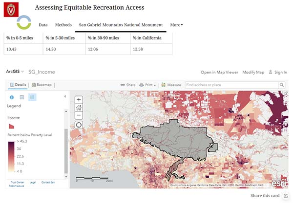
Public lands are spaces that have often been restricted, both explicitly and implicitly, to individuals with racial, economic, gender, able-bodied, neurotypical, and geographic privilege. Bernard completed a geospatial analysis to assess equitable recreation access to two areas of public land in the American West that Outdoor Alliance is working to protect and conserve.
Project Details
Full Title
Identifying and Developing Methods to Assess Equitable Recreation Access on Public Lands in the U.S.
Deliverables
- Python notebooks of GIS analysis and visualizations
- StoryMaps to communicate results
- ArcGIS Hub site
Environmental Topic
Land use
Partner Organization
Skills Used in This Project
![]()
Modeling
![]()
Maps and visualizations
Get to Know Kathryn Bernard

Undergraduate Major
Psychology
Current Job
Conservation information manager, The Nature Conservancy
How did the EOI program prepare you for this project?
“More important than any specific information covered in the curriculum was the practice troubleshooting issues and researching solutions that I gained through the EOI program. Though I used many tools that were completely new to me, I was able to successfully troubleshoot all the issues that arose.”
“The EOI program has opened doors for me that I never knew existed, and I am very grateful to have made the switch to working in conservation.”
