This page is archived and kept only for reference. The information may be outdated or inaccurate, and the content may not meet current accessibility standards. If you need assistance, please email us at communications@nelson.wisc.edu.
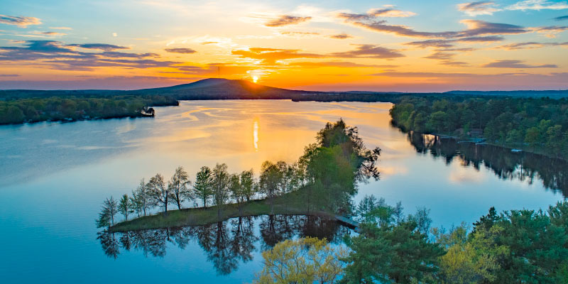
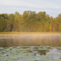
Wetlands and riparian land, or the area between land and a river, are essential resources that provide flood protection, erosion control, and a variety of other benefits. Understanding and protecting these resources is a primary goal for Marathon County conservation leaders, who recently partnered with the University of Wisconsin-Madison UniverCity Year program and the Nelson Institute Environmental Observations and Informatics (EOI) master’s program, to gain insight into the county’s wetlands.
This collaboration was facilitated by the UniverCity Year program, which brings faculty, students, and members of Wisconsin communities together to address local challenges through engagement, university research, and state-of-the-art problem-solving approaches. In this case, UniverCity Year partnered with Marathon County Conservation, Planning, and Zoning Department leaders Paul Daigle and Jeff Pritchard with students in two different Nelson Institute courses; Environmental Studies 950: Remote Sensing Seminar taught by Sarah Graves, Program Coordinator for EOI, and Nathan Schulfer, director of international and professional programs at the Nelson Institute and Environmental Studies 978 GIS for Environmental Observation & Informatics, taught by Nelson Institute PhD student Naomi Louchouarn. Together, course instructors and students used Global Information Systems (GIS) mapping to analyze wetland and riparian resources throughout Marathon and answer questions and concerns that were posed by Marathon County conservation leaders.
“I saw the possibility to get a lot of smaller projects done within our department, especially from the environmental side,” said Paul Daigle, county conservationist. “We submitted a number of projects [to UCY] and didn’t know what to expect, but I knew working with the students that they would try their best to meet our goals.”
The projects submitted by Marathon County included the wetlands project as well as those relating to data on groundwater protection, promoting soil health, and more. For the wetlands project, Daigle and Pritchard set clear goals for the students in terms of the data they wanted to gather on wetlands in the area. The students then utilized their skills in GIS to answer a variety of questions identified by Marathon County. Daigle and Pritchard worked directly with the class and the instructors as a client, often meeting with the students virtually. Although this did require a time commitment, Daigle noted that the students worked efficiently and effectively.
“It was not even close to the amount of work it would have taken if we did it ourselves,” Daigle said of the project. “It was a win-win situation and I really found that if we spent the time prepping these students and telling them the outcome we wanted within that first two weeks of class, it helped us get the product and the quality we wanted.”
The students also benefit from the hands-on learning, as the project gives them a chance to engage with a community and address challenges at a local level.
“GIS is, from my experience, hard to teach in a way that is exciting and useful because it’s easy to create step-by-step instructions but it’s hard to apply that in the real world. It just doesn’t really translate well,” shared course instructor, Naomi Louchouarn. “So, we designed this class to give students an opportunity to do a project that allowed them to be flexible and apply the tools that they were learning in the real world. This was an actual client that really needed GIS help. They knew what they were looking for, they just needed someone to come in and do it for them. And that was perfect for our students and a perfect collaboration in that sense.”
Schulfer echoed Louchouarn’s sentiments, noting that community-engaged classes, such as those in partnership through UniverCity Year, are an ideal learning tool for students.
“Students learn a lot through client-based courses like this because lots of data exists, but it really does take some time and effort to track it all down and organize it,” shared Schulfer. “One of the most important things that comes out of these projects, it seems to me, is students can start to understand where the gaps in data are. This is challenging for students, but eye opening, because in a world where we’re collecting lots of data all the time, there’s still always gaps. In the end, our students have the chance to help create a more complete picture of issues which seemed to be very unique to the client. As an example we learned that Marathon County has some unique geologic features, like layers of bedrock that sometimes make understanding water issues in the community challenging.”
Timothy Babb, a graduate fellow and EOI student confirmed Schulfer’s statement, noting that identifying the most applicable and useful datasets was a challenge on this project. But, these are the lessons he was hoping to learn as a part of the program.
“The Marathon County Project taught me that there is no perfect plan, dataset, or solution to solving environmental problems so as conservationists we must always be ready to adapt to changes,” Babb said.
Fellow cohort member Ben Bagniewski also appreciated the lessons in data management and the technical skills he gained but noted that the greatest lesson from this project was the realization that it’s okay to not have an immediate answer to every question a client is asking.
“It’s okay to pause, brainstorm, strategize with teammates or cohort members, advisors, technical forums, etc., and come back and try something else,” Bagniewski said. “Utilizing the resources at your disposal – those with more experience and knowledge than you – has been an important lesson through our time in the EOI program.”
As a part of this project, students in the Environmental Studies 978 course spent the fall 2021 semester working with Daigle and Pritchard to learn more about the county’s unique needs before presenting data and their GIS findings in a virtual meeting between the class and Marathon County leaders in December.
“In those presentations they took a large amount of information and synthesized it in a way that was easy to understand and apply, and that’s huge,” said Louchouarn. “Seeing improvement in how the students manage their data, how they produce the maps, and then how they write up and communicate those results were some of our learning goals and I was very impressed with the students.”
The findings shared in the December presentations will be captured in a report that will be shared with Marathon County, posted to the UniverCity Year website, and used by UniverCity Year and Marathon County to implement suggestions outlined in the report. While the final report is still pending, the presentations were met with positive feedback.
“I do think that the partner gets a helpful product,” Schulfer said. “Jeff and Paul seem to feel like they will be able to use a lot of these deliverables and maps pretty quickly to start either more effective planning, or really just to show the community in and around Marathon County a little bit of a visual story about what’s happening with their water resources.”
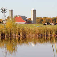
Daigle noted that he plans to use this data to inform their work with farmers who have an interest in water quality improvement projects, soil erosion control, farmstead runoff control and more. He said this work will also be used to educate and inspire farmers and other community members to protect these areas. Overall Daigle shared, “It’s been a positive outcome.”
In the future, the Nelson Institute courses and Marathon County hope to continue to partner with the UniverCity Year program on a variety of other projects. For Daigle, the program provides quality assistance that he says saves the county time and money. For the Nelson Institute, the program provides students with a unique learning opportunity that supports hands-on education and community building.
“We have worked with UCY for a number of years now, but mainly in our conservation planning course in the Environmental Conservation program. UCY is a really great partner for us because their work is client-based,” Schulfer said. “And we really lucked out with Jeff and Paul because they committed themselves to being involved in the project and they provided tremendous support to our students. Hopefully the work of the EOI students has an impact on their work far into the future.”