


On some days, Madison’s streets and buildings trap enough heat to make the city noticeably warmer than the surrounding countryside. On others, the opposite occurs. New research co-authored by Elizabeth Berg and Christopher Kucharik explores the weather conditions behind these shifting patterns and offers new insights for urban climate planning.
Published in City and Environment Interactions, the study analyzed 12 years of data from an extensive network of temperature sensors to better understand how weather, seasonal patterns, and longer-term climate variability influence the temperature differences between the city and its surrounding rural areas. Rather than treating the urban heat island as a static phenomenon, the researchers found that its intensity shifts considerably depending on environmental conditions.
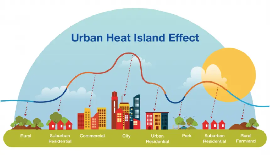
The study identified wind speed as the strongest and most consistent driver of urban heat island intensity, with higher winds reducing temperature differences between urban and rural areas throughout the year. Other weather factors, including temperature and precipitation, influenced the urban heat island differently depending on the season.
The researchers also documented more frequent “inverted” heat islands — periods when urban areas were actually cooler than surrounding rural landscapes — than had previously been observed in Madison or comparable cities. Together, the findings underscore the importance of long-term, year-round monitoring to better understand local climate patterns and provide valuable insights for designing and evaluating strategies to reduce urban heat in Madison and cities around the world.

